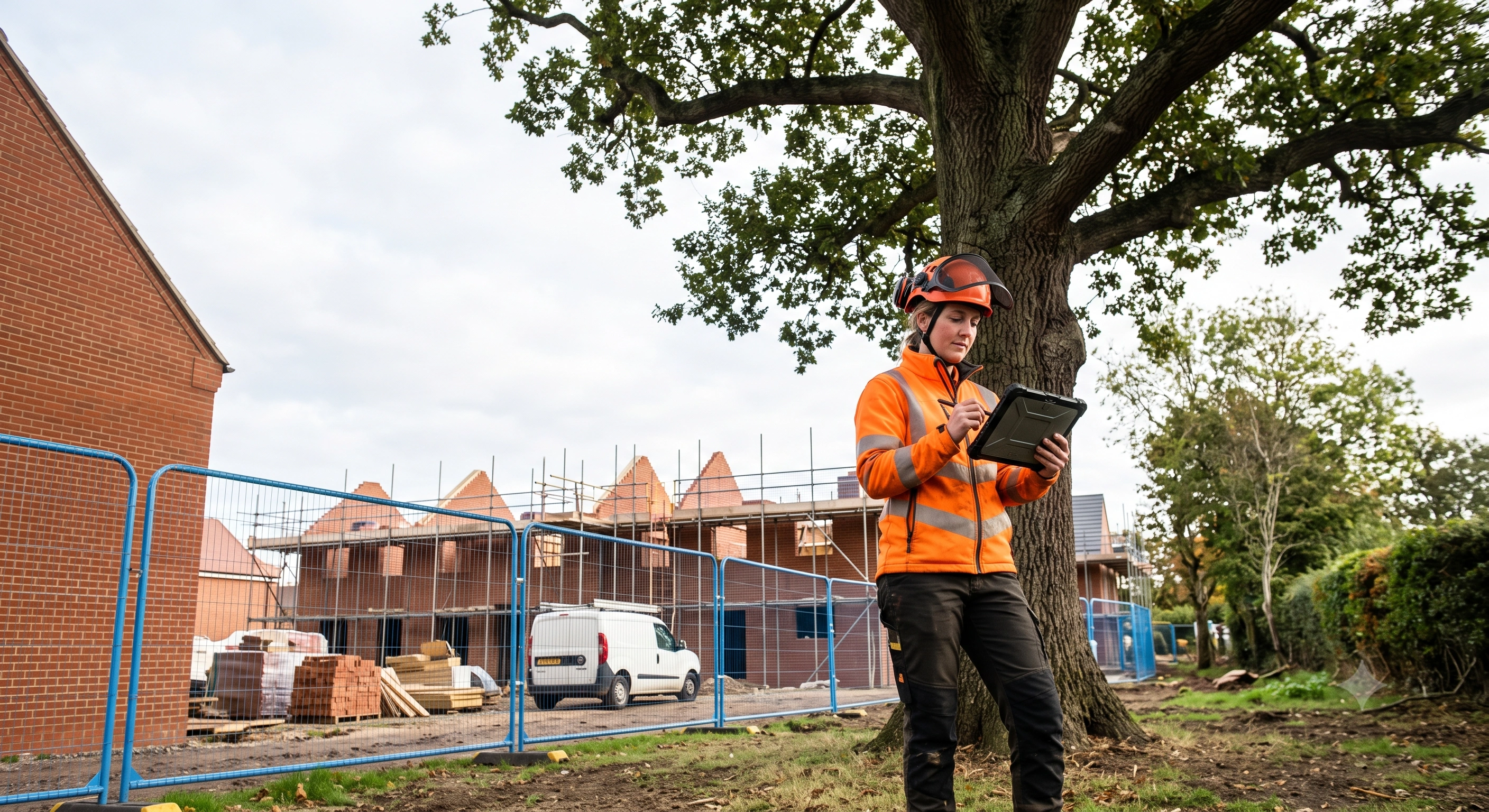
A Berkshire property developer submitted planning applications for a residential extension in January 2026. The local authority returned the documents within 48 hours. Their reason: no BS5837 tree survey, despite three mature oaks standing within six metres of the proposed footprint. Three weeks of delay followed while a qualified arboricultural consultant completed the assessment.
A BS5837 tree survey is a mandatory assessment under British Standard 5837:2012 that evaluates trees on or near development sites. It categorises each specimen's retention value and calculates Root Protection Areas (RPAs)—the soil zone where roots actually live—to inform planning decisions and construction method. Every UK local authority requires this survey when trees fall within the development's influence zone. The report becomes the technical foundation for Tree Constraints Plans and Arboricultural Impact Assessments.
BS 5837:2012 – the British Standards Institution technical standard titled "Trees in relation to design, demolition and construction – Recommendations", published 30 April 2012 (ISBN 978 0 580 69917 7), establishes the framework for assessing tree quality, calculating protection zones, and integrating retained trees into development layouts.
Key Takeaways
- BS 5837:2012 mandates tree surveys for most UK planning applications where trees exist on or within 15 metres of the site boundary
- Root Protection Area (RPA) is calculated as stem diameter (measured at 1.5m height) multiplied by 12, creating a circular protected zone where no excavation or ground compaction is permitted
- Trees receive grades: A (retain almost always), B (retain where possible), C (retain unless development benefits justify removal), or U (remove regardless)
- When category A or B trees cannot be retained, local authorities require 2:1 or 3:1 compensatory planting before removal consent is granted
- A Tree Constraints Plan (TCP) translates survey data into spatial mapping that architects and engineers use to refine designs around protected zones
What Is a BS5837 Tree Survey and Why Is It Required for Planning Permission?
BS 5837:2012 establishes the assessment methodology UK planning authorities rely on to evaluate how proposed development affects existing trees. The British Standards Institution published this standard on 30 April 2012, replacing the 2005 version with updated guidance on Root Protection Area calculation, tree categorisation, and construction exclusion zones. Chapter 4 specifies what data must be recorded for each tree and how that information feeds into planning decisions.
The UK Government confirms in its Tree Survey Explanatory Notes (updated June 2024) that tree surveys must follow Chapter 4 of BS 5837:2012. This is now the de facto requirement across England, Scotland, Wales, and Northern Ireland. Local authority validation checklists universally list BS5837 surveys as mandatory when trees are present. Without an accepted survey, planning officers will not validate the application. The result: weeks or months of delay before the approval process even begins.
When Do You Need a Tree Survey for Planning Applications?
You need a BS5837 tree survey whenever your planning application involves construction activity within the rooting environment of trees on your site or neighbouring land. This triggers for new builds, extensions, demolitions, hard landscaping (driveways, patios), and underground services (drainage, utilities). The requirement applies equally to trees protected by Tree Preservation Orders (TPOs) and those in Conservation Areas, though the legal framework differs slightly.
Local authority validation lists determine survey necessity based on three factors: proximity (trees within 15 metres of the development boundary), development type (structures, hard surfaces, excavations), and local policy. Some councils require surveys for all applications regardless of tree presence, using the survey to confirm no trees exist on site. If your site plan shows trees or aerial imagery reveals canopy within the influence zone, expect the planning officer to request a BS5837 survey before validation proceeds.
How Does the BS5837 Tree Categorisation System Work?
BS 5837:2012 assigns every surveyed tree to one of four categories—A, B, C, or U—based on quality, condition, and remaining amenity value. This grading system translates arboricultural judgment into a standardised framework planners and developers understand. Category A trees often dictate where buildings can be positioned. Category U trees should be removed regardless of development plans.
The assessment weighs four criteria: physiological condition (health, vigour, disease), structural condition (decay, defects, past damage), estimated remaining contribution (years of future value), and conservation significance (rare species, historical associations, ecological importance). A tree must score well across all criteria to achieve category A. A single serious defect can drop it to category C or U.
Category A trees (40+ years of contribution): Exceptional specimens—rare species, exemplary form, significant landscape features, major cultural or conservation value. Examples: veteran oaks, specimen cedars in historic gardens, mature wild service (Sorbus torminalis). Planning policies strongly favour retention. RPAs are often extended beyond standard calculation.
Category B trees (20+ years of contribution): Trees in good condition with an estimated 20+ years remaining, forming significant amenity individually or in groups. This captures most mature development-site trees: healthy lime avenues, well-formed beech specimens, robust field maples. Retention is desirable, but removal may be justified where development benefits outweigh tree value and compensatory planting is provided.
Category C trees (10+ years of contribution): Trees with a minimum of 10 years remaining, often suppressed by neighbours, showing early decline, or common species of limited amenity. Young self-seeded sycamores, over-mature hawthorns, poorly formed specimens often fall here. Removal to facilitate development is generally acceptable with appropriate replacement planting.
Category U trees: Dead, dying, diseased beyond recovery, or posing immediate structural hazard. Remove within the short term regardless of development activity. Examples: ash trees with advanced Chalara dieback, storm-damaged stems with extensive basal decay, suppressed understory trees with less than five years' safe life expectancy.
What Is the Difference Between Category A and Category B Trees?
Category A trees possess exceptional qualities: rare species (black poplar Populus nigra subsp. betulifolia), notable age or size (a 400-year-old oak), outstanding form, or historical associations. Category B trees are healthy and valuable, but lack these exceptional characteristics. Practically speaking, category A trees almost never receive removal consent for development. Category B trees may be removed if the planning balance favours the scheme and compensatory planting is secured.
What Is Root Protection Area (RPA) and How Is It Calculated Under BS5837?
The Root Protection Area defines the minimum rooting environment a tree needs to survive construction disturbance. It extends outward from the stem in a circular zone. Any construction activity within the RPA—excavation, ground-level changes, compaction from machinery or material storage—risks severing structural roots and compromising stability or health. BS 5837:2012 requires all development layouts to avoid RPA encroachment wherever possible. Where encroachment is unavoidable, the Arboricultural Impact Assessment must specify protective construction methods.
The standard calculation is straightforward: RPA radius (metres) = stem diameter at 1.5m above ground level × 12. A tree with a stem diameter of 0.5 metres yields an RPA radius of 6 metres, creating a circular protected zone of approximately 113 square metres. This 12:1 multiplier reflects research into root spread patterns for typical British tree species. Roots capable of providing structural support generally extend 10–15 times the stem diameter; the factor of 12 provides a conservative middle ground.
How Do You Measure Stem Diameter at 1.5m for RPA Calculations?
Stem diameter is measured at precisely 1.5 metres above ground level on the upslope side of the tree, using a diameter tape or girth tape (circumference divided by π). This standardised height eliminates variations from buttressing or root flare. On sloping ground, measure from the highest point where roots meet soil. Where a stem forks below 1.5m, treat each fork as a separate stem and calculate individual RPAs, then combine them. For multi-stemmed trees (such as field maple or hazel coppice), measure the diameter of each stem at 1.5m and combine areas, or measure the collective diameter at the narrowest point below the lowest fork if this occurs beneath 1.5m.
For a tree with a 0.5m diameter stem, the RPA radius is 6 metres (0.5 × 12), creating a 113m² circular protected zone. Within this zone, excavation, compaction, and construction traffic are prohibited without specialist arboricultural method statements.
BS 5837:2012 permits RPA shape modifications where site constraints prevent a circular zone: elongated ellipses, asymmetric radii, or sector shapes may be calculated provided the total area remains equivalent to the circular default. These modifications require arboricultural justification and must not reduce the RPA below the calculated area. For hedgerows and linear tree groups, a continuous RPA is calculated as a strip extending from the centre line at a width determined by average stem diameter × 12, typically resulting in a 3–6 metre buffer on each side.
What Is a Tree Constraints Plan (TCP) and How Does It Differ from a Tree Survey?
A Tree Constraints Plan translates raw survey data into a visual overlay on your proposed site layout—showing exactly where trees, canopies, and Root Protection Areas will constrain what you can build. The tree survey itself is just a tabulated dataset: species names, measurements, categories. The TCP is where architects and engineers actually use that data to reposition buildings, reroute access, and redesign service runs to avoid tree damage. Both documents are mandatory in every BS5837-compliant planning application. The survey provides the evidence; the TCP applies it to your scheme.
A TCP must show tree positions (surveyed to within 0.5m using GPS or measured from fixed boundaries), crown spreads plotted across all four compass directions, Root Protection Areas drawn as shaded circles or polygons, colour-coded categories (green for A, blue for B, grey for C, red for U), existing buildings, topography with spot heights, and any Tree Preservation Orders or Conservation Area designations. Crucially, the TCP uses the same base plan as your proposed site layout, allowing direct visual comparison between what the trees need and what your development wants to occupy.
The workflow moves in stages. First: the arboricultural consultant surveys trees and records the raw field data. Second: that data is mapped onto a scaled plan to create the TCP, immediately revealing whether your proposed structures will encroach on Root Protection Areas or require removals. Third: if they do, you commission an Arboricultural Impact Assessment to evaluate those impacts, quantify losses, and propose mitigation. The TCP is the pivot point—it's what forces the hard design conversation before you're too committed to a layout.
When Do You Need an Arboricultural Impact Assessment (AIA) Beyond the Standard Survey?
An AIA becomes necessary the moment your development cannot avoid Root Protection Area encroachment, requires removal of category A or B trees, involves construction within protective buffer zones, or proposes significant ground-level changes within rooting zones. Without one, planning officers cannot determine whether your scheme complies with local tree policies or whether mitigation is adequate—and they will ask for it before validation.
The AIA covers several critical components. A tree retention and removal schedule explicitly states which trees stay, which go, and why. Protective barrier specifications detail post-and-rail chestnut fencing or welded mesh panels and where they'll stand. Construction exclusion zones mark areas where vehicles, storage, and excavation are forbidden. An Arboricultural Method Statement describes exactly how work will proceed within RPAs without unacceptable damage. For complex schemes with underground services or hard surfaces within RPAs, you may need no-dig techniques, cellular confinement systems, or hand-digging protocols specified down to the centimetre.
UK local authorities enforce compensatory planting ratios when tree loss is unavoidable: 2:1 for category B trees (two replacements per tree removed) and 3:1 for category A trees, calculated by stem diameter or canopy area rather than simple headcount. Remove a category A oak with a 0.8m stem diameter? Plan on planting three semi-mature specimens at 0.25m diameter each—or more younger trees—to achieve equivalent future amenity value. These ratios aren't statutory but are embedded across England, Scotland, and Wales in local development frameworks and consistently upheld on appeal. That said, they can shift based on site context, local policy, and ecological gain arguments—which is where an experienced AIA author makes the difference.
What Is an Arboricultural Method Statement?
An Arboricultural Method Statement is your operational manual for construction near Root Protection Areas. It specifies ground protection systems (load-spreading panels, geotextile-and-scaffold installations), defines access routes for plant and materials, sets out hand-digging protocols where machines would sever roots, and establishes site monitoring to ensure compliance. Once planning consent is granted, contractors are legally bound to follow it. Breach of an AMS can trigger enforcement action, stop notices, and prosecution under the Town and Country Planning Act 1990—with unlimited fines if TPOs apply and damage is deliberate or reckless.
Who Can Conduct a BS5837-Compliant Tree Survey?
Only a qualified arboricultural consultant should conduct a BS5837 survey. This typically means holding the Arboricultural Association's Professional Diploma, the Royal Forestry Society's Professional Diploma in Arboriculture, or an equivalent qualification demonstrating competence in tree assessment, risk evaluation, and BS5837 methodology. The BSI publishes the standard but doesn't certify surveyors; professional credibility comes through membership in the Arboricultural Association, Institute of Chartered Foresters, or registration as an Arboricultural Consultant. Planning authorities will reject surveys from unqualified practitioners regardless of formatting compliance—and you'll lose weeks waiting for a second survey.
Check a surveyor's credentials three ways. Search the Arboricultural Association's online directory for current membership. Confirm professional indemnity insurance (minimum £1 million; £5–10 million is standard for development work). Ask whether the local authority recognizes them—some councils maintain approved consultant lists or will flag concerns at pre-application stage before you've paid for a survey.
Do I Need a Certified Arboriculturist or Can Any Tree Surgeon Do the Survey?
Tree surgeons with NPTC chainsaw certificates or Level 3 Diplomas in Arboriculture are trained to climb, prune, and fell safely. That's not the same as conducting a planning-grade survey. A BS5837 survey requires consultancy-level knowledge: tree biology, British Standards methodology, planning policy, technical writing. Tree surgeons have operational skills. Consultants have assessment and design skills. Submit a survey authored by a tree surgeon without consultancy credentials and planning officers will reject it at validation—costing you weeks while a properly qualified consultant re-surveys the site from scratch.
What Information Must a BS5837 Tree Survey Report Include?
BS 5837:2012 Chapter 4 mandates specific data for each tree: botanical and common names, height in metres (clinometer or laser rangefinder), stem diameter at 1.5m above ground in millimetres, crown spread north/south/east/west in metres, life stage (young through veteran), physiological condition (good/fair/poor/dead), structural condition (good/fair/poor/failed), estimated remaining contribution in years, and preliminary management recommendations independent of development.
Reports must include high-resolution photographs of every category A and B tree—full crown from at least two angles, plus any significant defects affecting the condition grade. Tree locations are referenced by GPS coordinates (British National Grid or WGS84 with stated accuracy) or measured distances from permanent fixed points like building corners or boundary markers. The introduction documents survey date, weather conditions, and access limitations that constrained assessment (dense undergrowth obscuring stem bases, foliage blocking crown inspection).
A good report cleanly separates observations made during the survey (factual condition and measurement data) from recommendations for tree management. This distinction matters: it prevents planners from confusing which recommendations are immediate safety issues (remove category U trees now) versus which are design constraints for your proposed development (retain category A specimens within exclusion zones). Mixing them creates ambiguity and delays.
| Survey Component | Purpose | Typical Content |
|---|---|---|
| Tree schedule table | Data repository for all surveyed specimens | Tree tag number, species, height, stem diameter, crown spread, age class, condition grades, category, RPA radius, management notes |
| Tree location plan | Spatial reference showing positions and canopies | Scaled site plan with tree positions, crown spreads, tag numbers, boundary lines, existing structures |
| Photographic record | Visual evidence of condition and context | Numbered images keyed to tree tags, showing full crown and any defects |
| Methodology statement | Explains survey standards and limitations | Reference to BS 5837:2012, equipment used, weather, access constraints, datum for measurements |
Takeaway: A complete BS5837 report combines tabulated data, spatial mapping, photographs, and methodological transparency. Planners and designers can then make informed decisions about tree retention and layout without revisiting the site themselves.
How Much Does a BS5837 Tree Survey Cost and How Long Does It Take?
Costs vary by site size, tree density, accessibility, and report scope. A typical residential project—0.1 to 0.5 hectares with 10–30 trees—runs £600–£1,200 for a standalone survey. Larger commercial sites with dense tree cover may cost £1,500–£4,000 or more, especially with difficult access or trees on multiple parcels. Bundled packages (survey + TCP + AIA) often cost less than commissioning separately: expect £1,800 to £5,000 depending on complexity. Fieldwork typically takes one to three days; report writing and plan production add another week or two. Budget this time into your pre-application timeline.
Fieldwork duration hinges on two variables: tree count and terrain. A straightforward suburban plot with a dozen trees typically requires half a day on site. A wooded 2-hectare parcel? Plan for two or three full days of comprehensive assessment. Report preparation then consumes 1–2 weeks as the consultant processes measurements, researches species characteristics, grades trees against BS5837 criteria, produces scaled plans, and writes the narrative. Revision cycles extend this further—the developer may request amendments following initial design reviews, or the planning officer may flag deficiencies that need correction before validation.
Commissioning all three documents (survey, TCP, AIA) from the same consultant in a single instruction typically costs 20–30% less than separate sequential commissions. You eliminate duplicate site visits, ensure data consistency across documents, and streamline the process. Developers who submit planning applications with only a tree survey often discover mid-application that the council requires a TCP or AIA as well, forcing a retrospective commission at higher total cost and delaying determination by several weeks. It's a costly mistake to avoid.
Need a BS5837 survey for planning?
Find a qualified arborist
BS5837 surveys must be carried out by a qualified arborist. We connect UK homeowners and developers with vetted professionals.
Published by Tree Surgeon Leads UK, a specialist marketing and lead generation agency working with UK tree surgeons.
Frequently Asked Questions
What happens if I submit a planning application without a BS5837 tree survey?
The local authority will invalidate your application at the validation stage. This means the statutory determination clock does not start—your 13-week (or 16-week) determination period has not begun. Planning officers return the documents with a validation checklist identifying missing items. You commission the survey, wait for report completion (typically 2–3 weeks), and resubmit. Minimum delay: one month. More realistically, two.
Can I remove a category C tree without planning permission?
Category C is an arboricultural assessment, not a legal protection status. The critical question is whether the tree itself is protected—by a Tree Preservation Order or because it stands within a Conservation Area. If either applies, you need consent to remove it, regardless of category. If the tree has no legal protection and sits on your land, removal is generally permitted. That said, some councils encourage retention and compensatory planting even for category C specimens, and this may influence future applications on the site.
How often do BS5837 tree surveys need updating?
Surveys remain valid for planning purposes for approximately 12–18 months. After that, tree condition, size, and health may have changed sufficiently to render the data inaccurate. Submit a planning application more than 18 months after the survey date, and expect the planning officer to request an updated assessment. Seasonal variation also matters—winter surveys may underestimate crown spread, whilst summer surveys capture fuller foliage data and are generally preferred.
Does a BS5837 survey cover trees on neighbouring land?
Yes. Any tree whose canopy overhangs the development site or whose Root Protection Area extends into the site must be included, even if rooted entirely on neighbouring property. The consultant will assess these trees from your land and may request neighbour access for accurate measurement—though this is not always granted. The Tree Constraints Plan shows off-site trees, and the Arboricultural Impact Assessment must consider impacts from construction vibration, root severance at the boundary, or ground level changes affecting the rooting environment.
What is the difference between BS5837 and BS3998?
BS 5837:2012 governs tree surveys and management in relation to development and construction. It establishes the framework for planning applications. BS 3998:2010 ("Tree work – Recommendations") specifies best practice for tree surgery operations—pruning techniques, felling methods, safety procedures, and work quality standards. A BS5837 survey may recommend pruning works, which should then be carried out in accordance with BS 3998. The two standards are complementary: BS5837 determines what tree management is appropriate for development, and BS3998 defines how that work should be executed.